The Transit to Total Station
Program: GIS / Surveying / Drone Operations
The Transit to Total Station
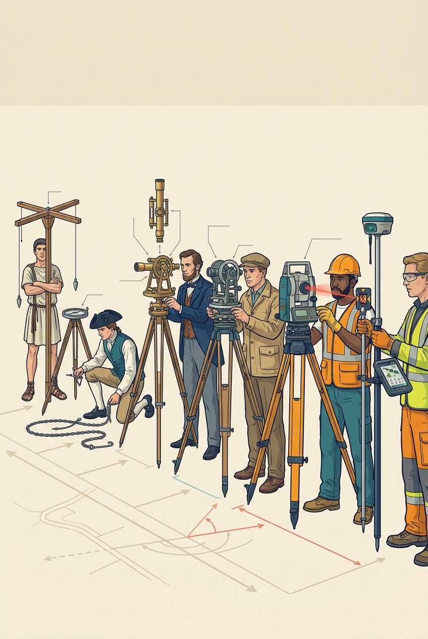
How do you measure land you cannot walk across? Angles and distances.
The groma. Roman surveyors lay out streets at right angles with crossed arms and plumb lines.
The chain and compass. Colonial surveyors, George Washington among them, run lines with a Gunter's chain and a magnetic compass.
1831. William J. Young of Philadelphia builds a transit whose telescope can flip over, fast enough for railroad surveys.
The theodolite. Angles read to seconds of arc.
Electronic distance. From the 1960s–70s, light and infrared measure distance; the total station combines angle and distance in one instrument.
GPS/GNSS. Satellite receivers give centimeter positions in real time.
See it. Gallery G9: transit, theodolite, total station, GNSS rover, drone, in a row. Look through each.
 QS5T99
reading